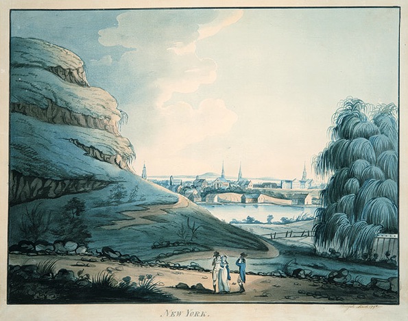

Collect Pond: 1700’s — The Collect Pond was a fresh water pond that served as the main water supply for the city, located just south of the intersection of present day Broadway and Canal Street. In the early 1700’s, the area was used for recreation, but by the late-1700’s, the pond became very polluted with industrial waste. (image: Wikimedia Commons, Archibald Robertson)
I recently gave a presentation about the history of the area of Manhattan that is now called SoHo at Judd Foundation for their artist/guides so that they could better contextualize Judd’s SoHo (1960’s/1970’s) as well as his building (constructed in 1870) within the larger history of New York City. I have revised and expanded the presentation as a slide show (see below). Click on any image to enlarge. Enjoy your trip down memory lane!
-

-
Collect Pond: 1700’s — The Collect Pond was a fresh water pond that served as the main water supply for the city, located just south of the intersection of present day Broadway and Canal Street. In the early 1700’s, the area was used for recreation, but by the late-1700’s, the pond became very polluted with industrial waste. (image: Wikimedia Commons, Archibald Robertson)
-
-
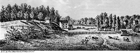
Lispenard’s Meadow: 1700’s — Just north of The Collect Pond was a swampy tract of land that, after being drained, was called Lispenard’s Meadow. Natural boundaries, such as Collect Pond and Lispenard’s Meadow, prevented northward development until 1775, when Broadway was extended north of Canal. (image: Drawn by A. Anderson, 1785)
-
-
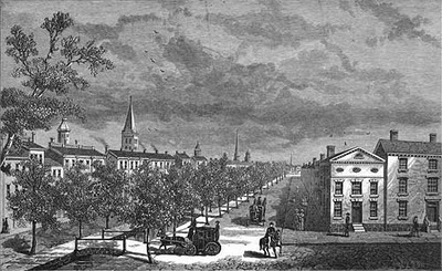
Canal Street: 1800’s — In 1807, the city widened a small spring that ran from Collect Pond to the Hudson River and planted rows of trees along both sides of this new canal. This path was known as Canal Street, even after it was paved over in 1821 because residents complained of its foul smell. (photo: via The Bowery Boys)
-
-
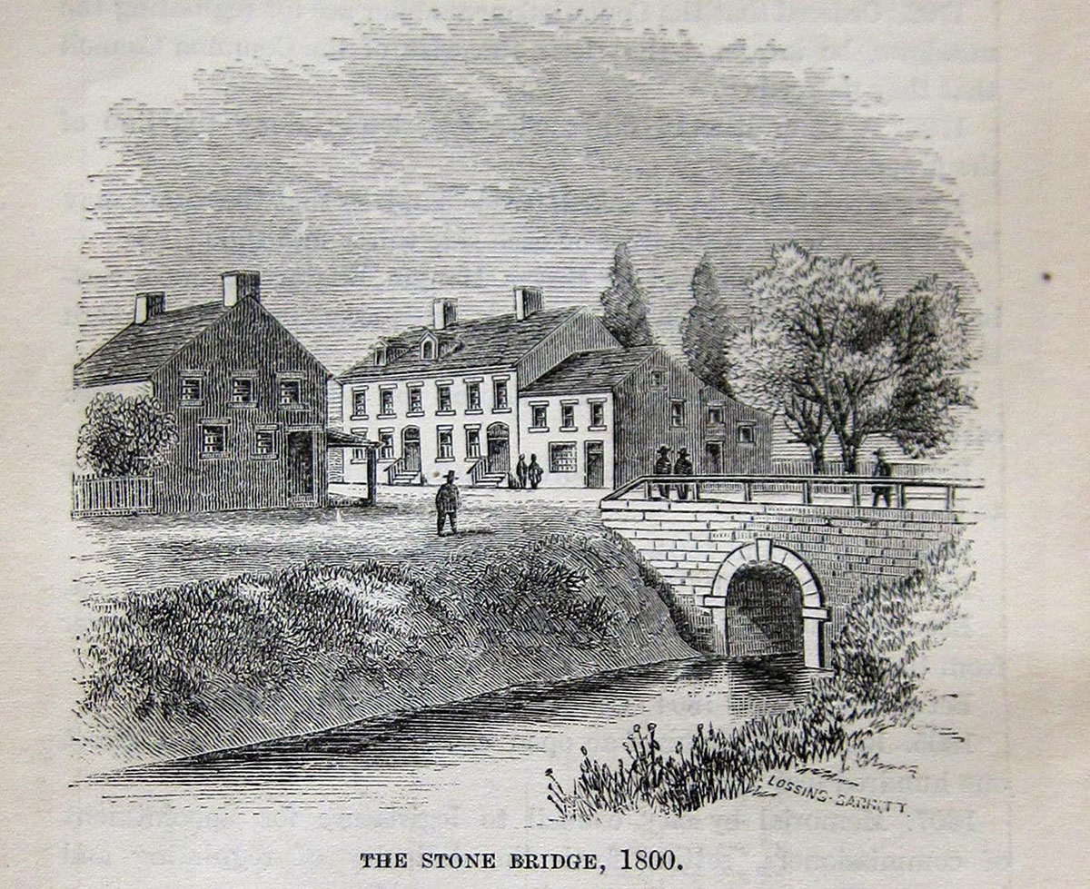
Stone Bridge: 1800’s — From “The Old Stone Bridge at Canal-street and Broadway” by Capt. Walker Bicker in The New York April 9, 1886: “Broadway was not paved beyond “the stone bridge” which stood where Canal-street now crosses Broadway. This was a famous resort for us schoolboys. It was considered “out of town”—all north beyond as well as the immediate vicinity was country, post and rail fences dividing the land into different sized parcels. This bridge spanned a small stream which conveyed water from the Collect on the east side of Broadway (where now stands the Tombs) to the west side, where was an extensive meadow covering most of the ground from Broadway to the north River and from Lispenard-street to Spring-street.” (image: The Manual of the Corporation of the City of New York, 1865)
-
-
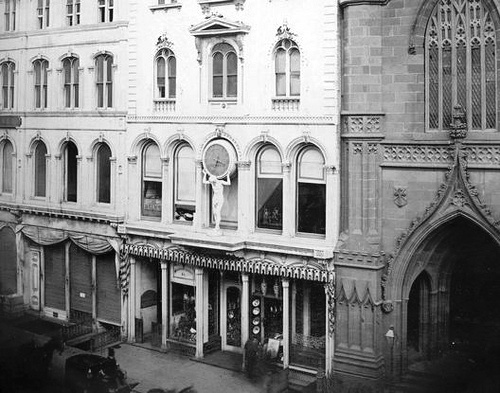
Tiffany’s: 1820’s — The area became a commercial destination for well-to-do New Yorkers. Tiffany & Co. had their store on Broadway between Prince and Spring Streets, where Banana Republic now resides. The Atlas clock in this image is the clock that now adorns the facade of the Tiffany & Co. store on Fifth Avenue at 57th Street. (image: via Curbed/Flickr)
-
-
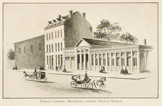
Niblo’s Garden: 1820’s — From the 1820′s until 1895, when it was demolished to make way for an office building, Niblo’s Garden at Broadway and Prince Street was one of New York City’s premier “pleasure gardens,” venues where wealthy New Yorkers could find diversion and amusement, both indoors and out, before the advent of public parks. (image: Marrycoz via The Bowery Boys)
-
-
Red Light District: 1850’s — The side streets of the area became lined with brothels and the neighborhood was known as New York’s first red light district. (image: NYPL via Ephemeral Ne York)
-
-
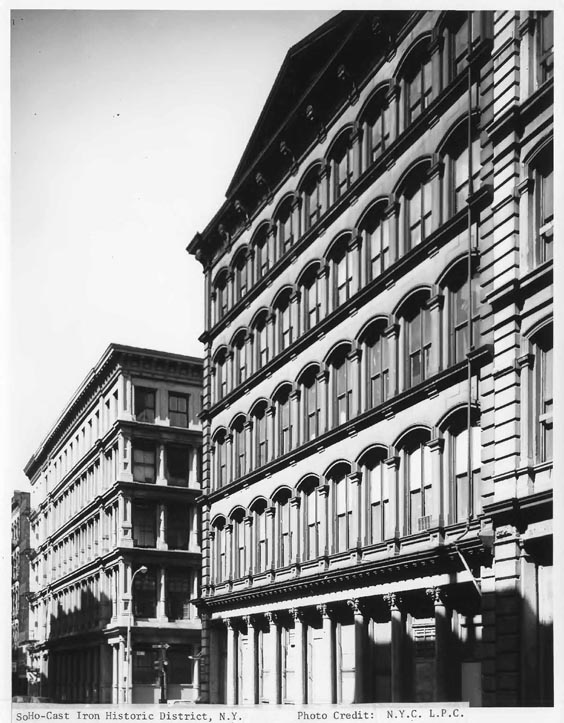
Cast Iron: 1870’s — SoHo is also known as the Cast-Iron Historic District, as it was designated by the Landmarks Preservation Commission in August 1973. There are approximately 250 cast iron buildings in New York City, most of them in SoHo and mostly dating from the mid to late-1800′s. (image: Landmarks Preservation Commission)
-
-
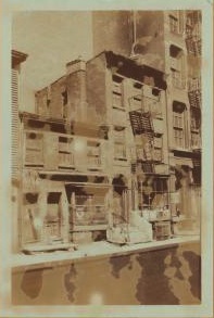
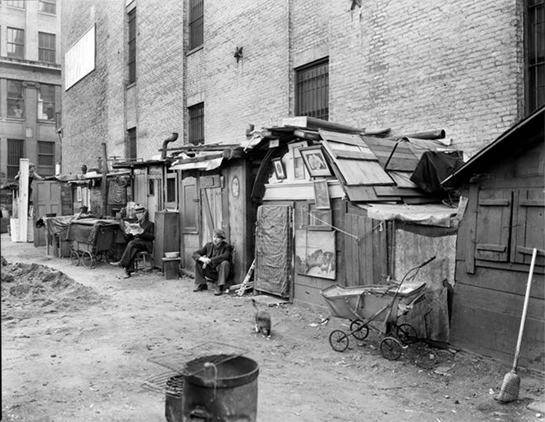
Great Depression: 1930’s — During the Great Depression, settlements such as this one on Houston and Mercer were often formed on empty land and generally consisted of tents and small shacks where people lived. (image: Berenice Abbott via MCNY)
-
-
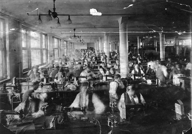
Factory workers: 1880’s-1950’s — After the Civil War, as New York’s commercial and entertainment centers began moving further uptown, to Union Square and then to what is now Times Square, the textile industry began moving into the area and remained until the 1950′s, when the first artists in search of large raw spaces began moving in. (image: ILR/Cornell)
-
-
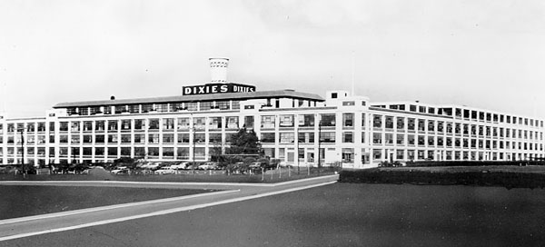
Modern Factory: 1950’s — As modern industry came to require a different type of structure — a more spacious one-story building with large loading zones for long tractor-trailers — the verticality of the SoHo buildings proved to be inefficient for moving goods. And as electrical lighting became less expensive, the large windows of the cast-iron buildings no longer offered the same advantage. (image: Lafayette College Library)
-
-
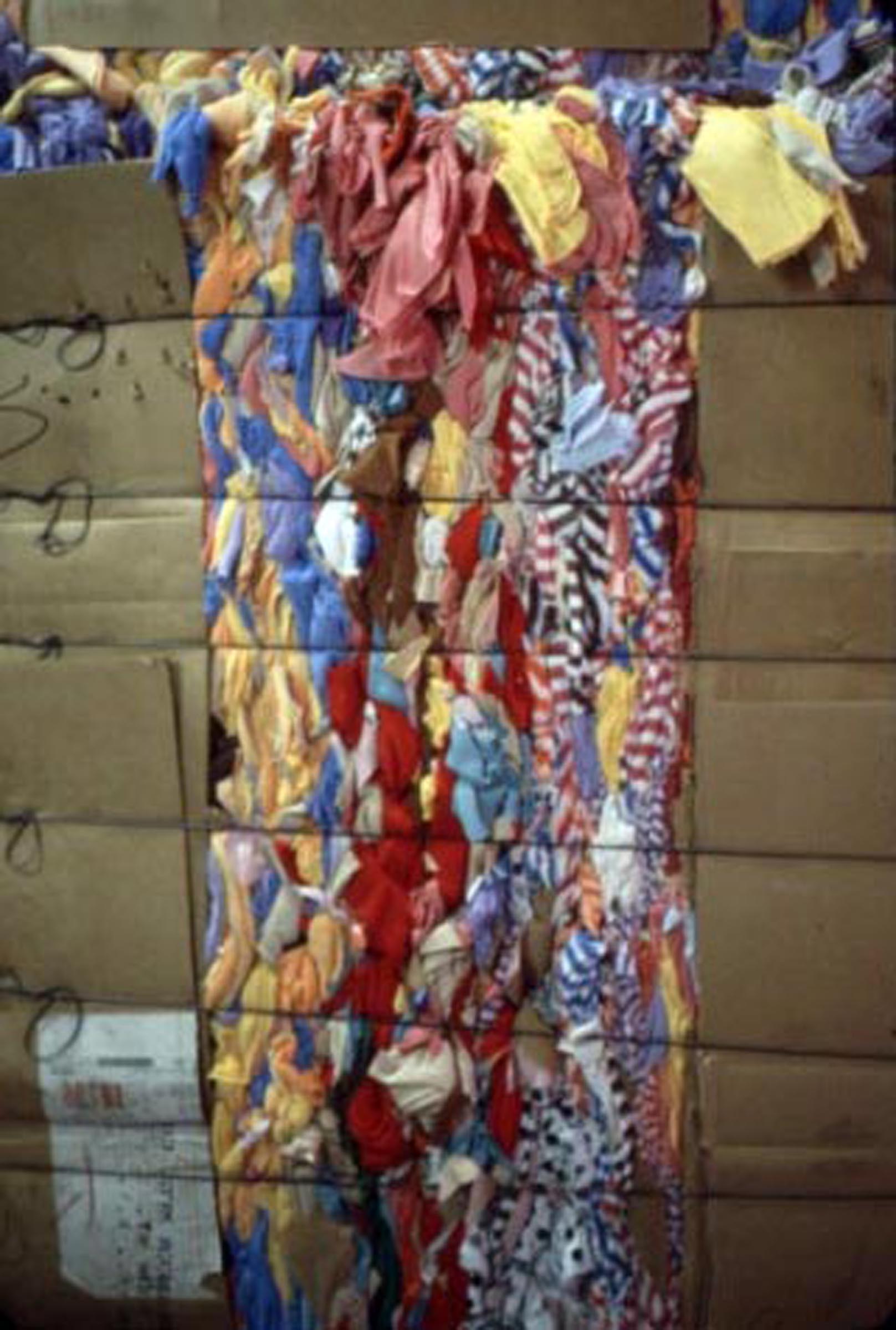
Rag Recycling: 1950’s-1960’s — Aside from manufacturing, SoHo was dominated by the rag trade. Businesses would collect fabric scraps, separate them by type of fiber, and send them out to be recycled. (image: Camilla McGuire)
-
-
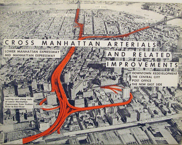
LOMEX: 1930’s-1960’s — First put forth in the 1930′s, the idea for the Lower Manhattan Expressway, or LOMEX as it was known, which was to run the length of Broome Street, gained support in the 1950′s and 1960′s and would have razed most of what is now SoHo and Little Italy. However, community opposition to the proposed highway connecting New Jersey and Brooklyn (via some of the most historically significant areas of New York City) defeated the project, and the highway was never built. (image: We Grow Media)
-
-
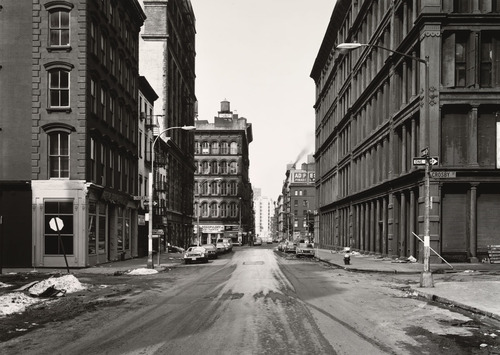
Rapkin Report: 1960’s — “The South Houston Industrial Area” (also known as “The Rapkin Report”), maintained that while the number of businesses in the area had declined over the years, the old buildings still housed small industries that employed many low-income and minority workers and were also a still-viable tax revenue source for the city. (image: Thomas Struth 1978 via MOMA)
-
-
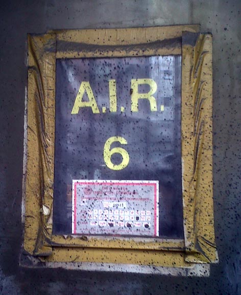
Artists’ Lofts: 1960’s-1970’s — Many buildings in SoHo had been built as commercial lofts, which provided large, unobstructed spaces for manufacturing and other industrial uses. These spaces attracted artists who valued them for their large areas, large windows admitting natural light and low rents. Before loft living in SoHo was legalized, artists living in commercial buildings posted AIR (Artist in Residence) signs that indicated that someone was living in the building and on what floor in case of a fire or other emergency.
-
-
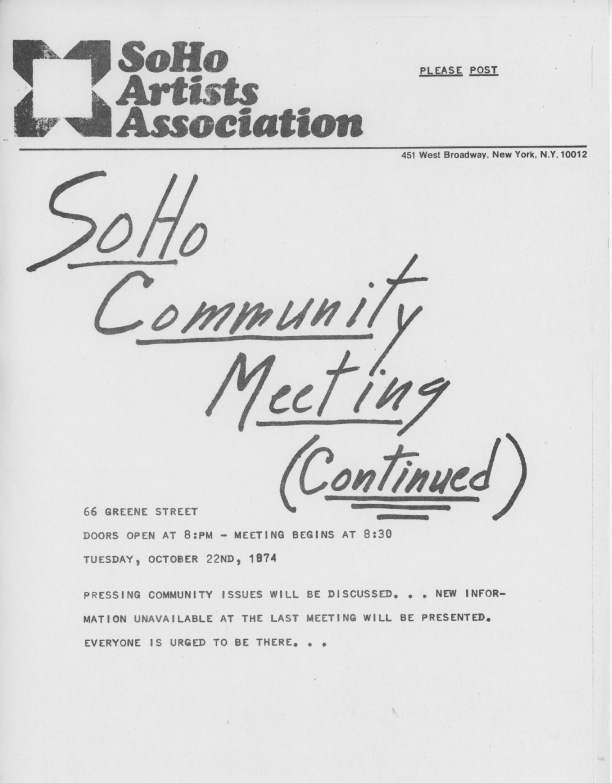
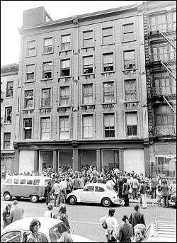
SoHo Artists’ Association: 1970’s — Before 1971, SoHo artists, almost all of whom also lived in their work spaces, were living there illegally. For a while, no one seemed to notice or care, the city pretty much looked the other way, but when non-artists looking for investment opportunities began noticing the profit potential of such spaces, artists, who, until then, chose to remain anonymous and hidden, came together to form the SoHo Tenants’ Association and then incorporated as The SoHo Artists Association (SAA), initially in order to legalize loft dwellings and fight to keep SoHo an affordable place for artists to work.
-
-
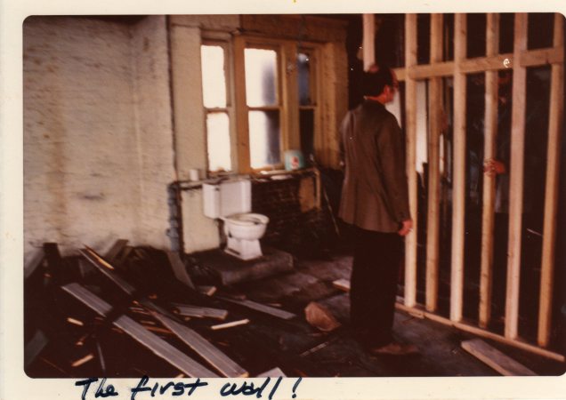
Loft Renovation: 1960’s-1970’s — Most of these spaces were also used illegally as living space. In 1971, the Board of Estimate in New York City passed a law legalizing loft living. This law was ultimately passed due to the SoHo Artists’ Association’s two-year battle with the city for the legalization of loft living in SoHo and set a precedent for how other neighborhoods and cities would approach adaptive reuse of non-residential urban areas. (image: Cass Collins)
-
-
Galleries: 1970’s — By the 1970’s, there were many artists living in SoHo and there was also a lively gallery scene where many of New York’s most prominent artists showed their work. Gallery owners from the Upper East Side began coming down to SoHo to open galleries along West Broadway and the streets running east of it. (image: fireplace chats blog)
-
-
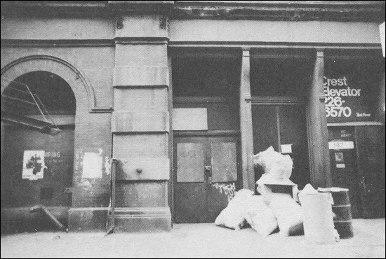
Trash: 1970’s — Because SoHo was zoned as a commercial neighborhood, there were no regular trash pickups, police patrols, or other “amenities” that were available in residential areas. These services came over time as neighborhood resident groups lobbied to have SoHo recognized as a mixed-use (residential and commercial) area.
-
-
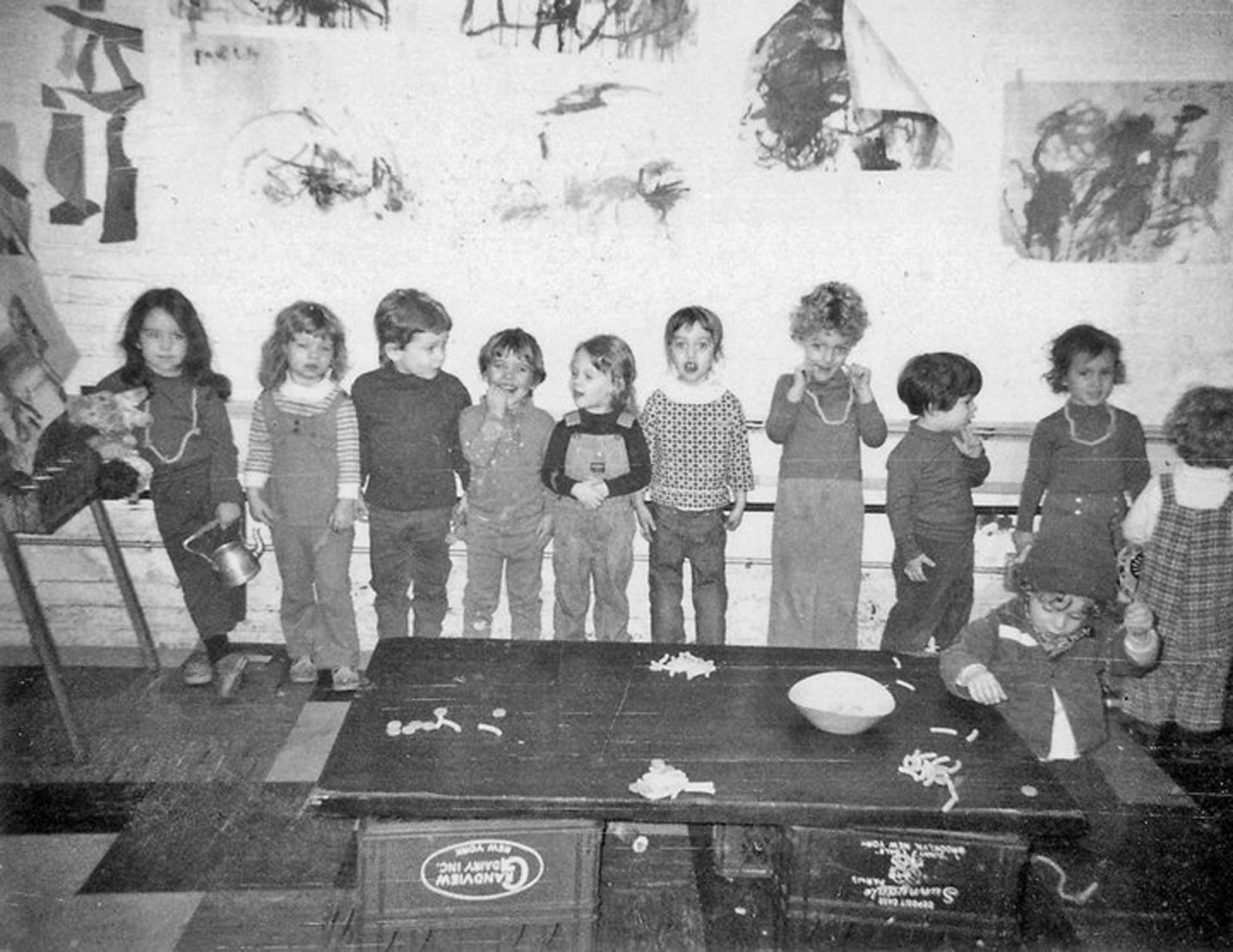
Community: 1970’s — The small population and isolation from infrastructure and resources created a tight-knit community of residents. Everyone knew each other by name and looked after one other. Because there were so few public services, the community provided for themselves, opening restaurants for locals and forming community daycare centers where neighbors often paid for goods and services with their time and involvement instead of cash. The SoHo Community Playgroup organized a rotating roster of parents who took turns looking after the neighborhood’s children. (image: Judy Reichler)
-
-
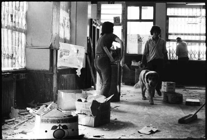
Food: 1970’s — The restaurant Food opened in late 1971, employed struggling SoHo artists and served inexpensive but hearty food to the local community. It was, for a long time, one of the only places to eat in SoHo. It was very ahead of its time in that it served fresh, seasonal foods cooked using local ingredients, not unusual today, but practically unheard of back then. (image: Carol Goodden, during construction of the restaurant)
-
-
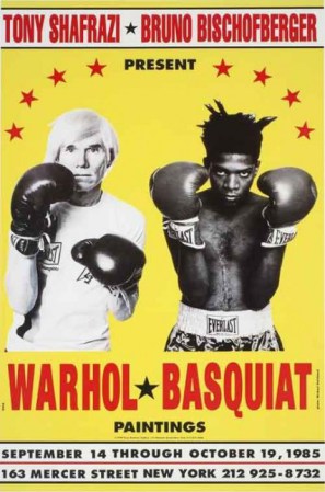
Warhol, Basquiat, Shafrazi: 1980’s — By 1985, when the Shafrazi Gallery mounted its Warhol-Basquiat show, advertised by the now infamous posters of the artists in boxing gloves ready to “fight” each other on canvas, SoHo had changed drastically. The neighborhood entered a new phase in its history where superstar artists and gallerists hobnobbed with their wealthy clientele who began coming to SoHo and eventually moving into lofts, driving up property values and driving out many who could no longer afford to live and work there.
-
-
Shopping and Dining: 1990’s — The change in the socio-economic makeup of SoHo residents brought with it commercial development. Art galleries began to move out of the neighborhood in the 1980s and 1990s, mostly to Chelsea where rents were more reasonable, and were replaced by high-end boutiques, restaurants, bars, and nightclubs.
-
-
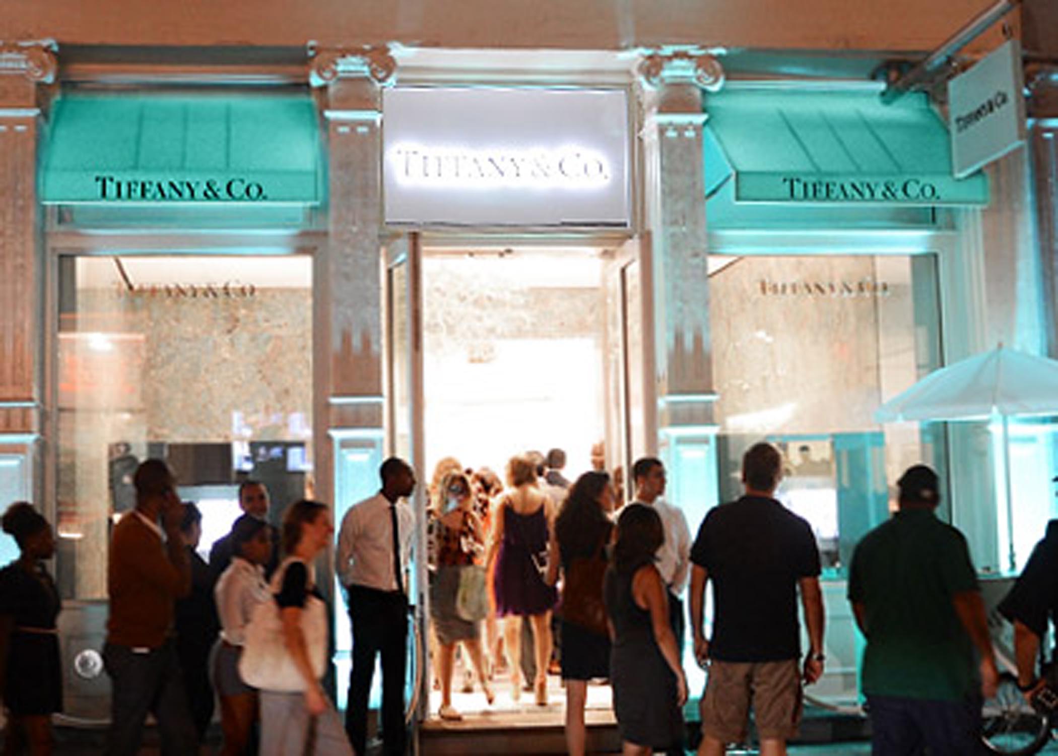
SoHo Today: Late-1980’s-present — SoHo’s location, the appeal of lofts as living spaces, its architecture, and its “hip” reputation as a haven for artists attracted wealthier people to the neighborhood as well as many exclusive stores and restaurants, including Tiffany & Co., who is back again after almost two centuries. SoHo is now a high-end neighborhood where real estate values continue to rise, as it has become one of the most coveted New York neighborhoods in which to live, work, and play.